Bandon Beach, Bandon, Oregon

Bandon Beach, Oregon coast | Photo by Jonathan Irish

Bandon Beach
Closest park: Crater Lake National Park 

The Oregon coast is well known for its marine climate, crashing seas, and sea stacks that jut out of the waters that line the northwest’s Pacific Coast. Weather and tides continue to shape the sea stacks, which provide shelter as habitats to marine life, and with tide pools exposed when the tide rolls out to sea at their bases. This area has a cool local flare that draws Oregonians beach-side during high season. A community effort to create massive designs from sand, right on the beach, is called “Circles in the Sand” and has served as a means of meditation, transformation, and healing since 2015. 

Walkway to Bandon Beach in Oregon from the parking lot | Photo by Jonathan Irish

Jonathan Irish photographing the sea stacks on the Oregon coast | Photo by Stefanie Payne

"Circles in the Sand" at Bandon Beach in Oregon is a community effort | Photo by Stefanie Payne

"Circles in the Sand" at Bandon Beach in Oregon is a community effort | Photo by Stefanie Payne

Road Trip from Kona to Hilo (and 3 Awesome Places to Explore on the East Side of the Big Island)

The Kona Coast on Hawai'i Island gets the most play in terms of tourist visitation to the Big Island. And not for nothing – Kona is beautiful and lively and is for sure an awesome place to hang ten. It is also a perfect jumping off point for an island road trip.

In remote and rural areas between Kona and Hawai'i Volcanoes National Park, visitors cross into ancient lands that remain relatively untouched by modern development. The main passage into the area is via Hawaii Belt Rd (HI-11), an 83-mile scenic drive between Kona and the national park with panoramic coastal views by your side nearly the entire way.

As you approach the park, you will enter the Kau region, home to the southernmost point in the United States. Kau is premier Hawai'ian coffee country – reason alone for a leisurely drive to Kau!

After Kau comes Volcanoes, the mythical goddess Pele's volcanic sanctuary and one of the first national parks to be established in the U.S. Many end their journey at Volcanoes and turn back to Kona from there... we suggest heading on east toward Hilo.

Because Hilo is on the rainy side of the island, many don’t make the effort to see it which is a real shame because the area is very special. In that spirit, we are highlighting three places on the east side of the Big Island where you can explore beyond the national park while digging into the soul of the island a little bit deeper. Read on! 

Made a gecko friend on Highway 11. 

Made a gecko friend on Highway 11. 

Hawai'ian kitsch at a thrift store on Highway 11.

Hawai'ian kitsch at a thrift store on Highway 11.

A cup of pure Kau coffee! ...with milk. ;) 


Rainbow Falls

Cascading water at Rainbow Falls!

Keep your eyes out for fragrant and colorful hibiscus – Hawai’i’s state flower.

Rainbow Falls, Waianuenue, in the Wailuku River State Park just west of Hilo is a lauded spot on the Big Island. The 80-foot falls are surrounded by tropical plant life, native birds, and glimmering rainbows that are spun by the sun and spray – reaching peak activity during the dawn hours. There is a short hike to the top of the falls overlooking dense vegetation and groves of banyan trees. 

The cascading falls pour into an ancient lava tube that according to legend, is home to Hina, the goddess of the moon. Waianuenue means “rainbow seen in water.”


Onomea Bay and the Hawaii Tropical Botanical Garden

Located 8-miles north of Hilo on the Hamakua Coast is the Hawai'i Tropical Botanical Garden – a hidden jungle universe whose history is without a doubt a big part of its charm.

Prior to 1977, the area was an overgrown wilderness until it was purchased by Dan and Pauline Lutkenhouse who transformed it into the tropical paradise that it is today. It was opened to the public in 1984. From on-site park sign:

When they were shown the for-sale, 17-acre property sitting on the ocean, it was so overgrown that a machete was needed to walk only a few feet through it, and filled with old cars, machinery, appliances, and trash of all kinds - but breathtaking… Dan immediately fell in love with this valley on the ocean and he envisioned his dream: he would purchase the land and plant a unique and welcoming garden of serenity in this beautiful valley on the ocean for people to enjoy. 

This place is amazing. The 40-acre valley is home to more than 2,000 plant species that can be enjoyed along a series of nature walks in the once overgrown forest. Every step from the parking lot to the shore leads you through natural beauties that the island is known for – orchid gardens, waterfalls, mango trees (here, they are centuries old and 100-feet tall,) coconut palms – until you reach the shore of Onomea Bay where the Pacific Ocean crashes into the volcanic shores.

This is one of those “get lost” places where you forget entirely that your car awaits at the top of the garden a relatively short walk away (and one of our new favorite spots on the Big Island.) 


Kipuka Guest Houses


Under a jungle canopy at Kipuka in the area of Pahoa, four bamboo guest houses powered by solar and watered by rain provide a completely unique place to stay in an off-grid setting. From the moment you are let into the gates and drive onto the sprawling grounds, you are greeted by the sights and sounds of the islands – it is very peaceful. Wraparound lenais with hammocks bring the grounds to your doorstep while tropical birdlife sings from the trees. With its jungle environment and elegant design, it is a meeting of an ancient landscape with a modern (yet humble) Hawai'i. It fit perfectly with our desire to have an off-the-beaten path experience during our national park adventure!

In Pahoa, stop at the Tin Shack for breakfast before hitting the road to the the next stop on your adventure. The café’s classic Hawaiian transplant hippie vibe is in full force and the food and local Hawai’ian coffee is perfection. Thanks to Mark, the owner of Kipuka, for the suggestion! 


Aloha and happy road tripping!

A Sacred Refuge on Hawai'i's Kona Coast

Did you know that in addition to Hawai'i Volcanoes National Park, there are three smaller national park units located on the Big Island? Kaloko-Honokohau National Historic Park is home to ancient rock art, petroglyphs, and a large population of sea turtles. Pu’ukohala Heiau National Historic Park is full of trails, coastal views, and is a place of worship that was once home to the great King Kamehameha. The third, and the one that we want to highlight here, is located 20-miles south of the Kona Airport, where Hawaiian Airlines will drop you off just a stones throw from an ancient Hawai'ian burial ground. 

Pu’uhonua o Honaunau National Historical Park

Pu'uhonua, meaning “place of refuge," is sacred royal ground. The royalty of Hawaii came here for the peace and tranquility, and it is also where lawbreakers sought safety from punishment and where wounded warriors went to heal after battle centuries ago. Today, the refuge is home to a variety of archaeological sites – carved wooden statues of the gods (Ki'i), royal fishponds, and Hawai'ian temples protected under a labyrinth of palm trees.

A royal fishpond in the center of the park.

A royal fishpond in the center of the park.

Pu'uhonua is a unique Hawai'ian beach, and because it is a sacred site and protected parkland, it is also free of tourist byproducts that tend to accompany a rowdy beach vacation (smoking, beach umbrellas, picnicking, pets, and the like are not permitted.) Pu'uhonua is a perfect half-day stop for peaceful exploration among tropical bird species that sing harmony with the drum of the Pacific seas crashing into the shores around you. Amazing!

Under a canopy of palms at Pu’uhonua o Honaunau National Historical Park on the Big Island.

Under a canopy of palms at Pu’uhonua o Honaunau National Historical Park on the Big Island.


P.S. If you have time to spare in Kona and want to eat at a local favorite, head to Killer Tacos

Mammoth Site, Hot Springs, South Dakota

More than 26,000 years ago, a karst sinkhole dropped into the Earth taking massive Columbian and wooly mammoths underground where they remained unearthed for millennia. In 1974, during construction of a housing development in the area of Hot Springs, South Dakota, builders discovered one tooth which led to a broader excavation of a hillside... as interested parties started digging in, they quickly realized that this was an important historical site, one where the largest collection of preserved Columbian mammoths exists on Earth today.

A typical tour through the building winds through an active research site where visiting scientists, researchers, and students continue to methodically excavate it in search of additional species, fossil records, and clues to our living past. They have so far uncovered 61 mammoths as well as several other extinct plant and animal species that lived on the planet during the last Ice Age.

Even those who aren’t into paleontology, history, and science will love visiting Mammoth Site for a chance to stand inside of a page from history to witness ancient animals frozen in time… it’s almost like you can imagine it happening before your eyes.

Getting to Mammoth Site is easy -– it is located just 8 miles from the south entrance of Wind Cave

Jewel Cave National Monument

One of America's most awesome and inspired rangers, Ranger Riley, leading us into Jewel Cave in South Dakota. She is on a quest of her own to visit all 417 National Park sites

Halfway between Badlands and Wind Cave national parks in the Black Hills area of South Dakota is Jewel Cave, the third-longest cave system in the world with more than 180 miles of mapped passages. Decorating the ceilings are calcite formations (called nailhead spar and dogtooth spar) that shimmer like crystals next to other formations including gothic-looking boxwork—which lives abundantly in Wind Cave—stalactites, stalagmites, popcorn, flowstone, frostwork, and our favorite formation: cave bacon, a type of flowstone. At Jewel Cave there is a 20-plus-foot slab of it that excites every single visitor joining a guided scenic tour with its exact likeness of every meat-eaters favorite food. 

A 20-foot slab of cave bacon at Jewel Cave. 

Some believe that Jewel Cave is connected to Wind Cave, although that is yet unproven. If it were determined that they were in fact connected and the system were to be mapped, it would become the longest cave system in the world, surpassing Mammoth Cave in Kentucky. If they are in fact connected, it is by geographic proximity more than character—these two underground worlds are very different from one another and are both uniquely fascinating places to visit. 

Jewel Cave was established in 1908 by President Theodore Roosevelt, who dedicated much of his term in office to building the foundation of the National Park Service (the reason he is called the "Conservationist President.”) After your exploration there, consider driving 35 miles up the road to tip your hat to him at Mount Rushmore, where he stands 60-feet tall on a granite cliff side.


Yet another cool place to #FindYourPark! Happy trails everyone. 

Mount Rushmore National Memorial

Just like the National Park Service, Mount Rushmore also celebrated a milestone birthday during 2016, turning 75 years old in October. 

Happy President’s Day everyone! In honor of the holiday, we wanted to share this stop along the road at one of America's most celebrated landmarks: Mount Rushmore National Memorial. It sits about half way between Badlands National Park and Wind Cave National Park on the western side of South Dakota.

For those who don’t know the details of Mount Rushmore off hand, here is a quick and dirty guide. Carved into granite batholith* rock in the Black Hills is the likeness of four of America’s greatest presidents: George Washington, Thomas Jefferson, Theodore Roosevelt, and Abraham Lincoln. It was sculpted by Gutzon Borglum and his son, Lincoln Borglum, during a 14-year span of time concluding in 1941. Under their guidance, 400 workers removed more than 450,000 tons of rock to carve out the 60-foot high formations. The idea was conceived of in the 1920s by Jonah LeRoy "Doane" Robinson, a state historian, who wanted to bring more tourism into South Dakota. Robinson’s idea proved to be a success—today more than 3-million visitors head to Mount Rushmore annually to see what is known as the “Shrine of Democracy.”

We arrived early in the morning to a thick blanket of fog that covered the veneer of our president’s faces… about 30 minutes later, before the sun came up and prior to hoards of visitors entering the gates, the fog lifted—only for a couple of minutes, and long enough so that we could capture the scene before the fog rolled back in. Even that short meeting allowed us time to stand in awe of Rushmore... it is place that is really exciting to see in person. How sculptures of that size could be created at such a massive scale and endure for such a long period of time is absolutely astounding and wonderful to see in its rocky flesh. Happy President's Day everyone! 


*A batholith is large-scale plutonic rock formed from cooled magma from deep within the Earth's crust. Half Dome in Yosemite is another example of a batholith. 

Wall Drug: The Legend

Callie Jean Mount (Payne) in front of her mural art at Wall Drug in the 1930s. You go grandma! Thank you for your bravery, creativity, and general badassness! 

Hi all, Stefanie here! I have a personal story to share alongside this stop along the road…

If you’ve driven through South Dakota, you’ve probably been to Wall Drug, one of the most famous road trip stops in the United states of America. It is legend, and for me, this stop had special meaning…

My grandmother was one of the first professional artists to be employed by Wall Drug—they brought her on during her high school years in the late 1930s to create murals outside of the newly minted tourist stop that has since become an institution among the U.S. road trip circuit.

Grandma Jean and I were very, very close. Throughout my life I've heard endless stories about my grandma’s youth in Rapid City, her life as a young artist, and her fearless streak of independence that certainly made way through the generations before landing on me. My grandma Jean was a badass—an entrepreneur, an artist, a real mover and shaker, and huge inspiration in my life. She passed away last year at the age of 95.

Driving into the Badlands and up to Wall Drug, I imagined how she might have gotten to work during here time there. What kind of car did she drive? What was her schedule like? Who were her friends? Did she like working there? These questions will remain largely unanswered. However, the institution remains, so we went to the site seeking a connection with the place she spent some time in her life—a place where she made art (and a definite must stop while visiting the Badlands in South Dakota.) 

We scoured Wall Drug endlessly to find the site of my grandma’s mural (seen next to her in the picture above.) Unsurprisingly it could not be found—there was renovation and expansion some time ago and out with it went my grandma’s art. But the soul of her designs remain there still—silhouetted renditions of installations featuring cowboys, ranch life, and other prairie art that still adorns the walls. The existing murals were crafted by another, but her flavor has remained.  

It is incredibly rewarding to know that my family—just like all of our families—have contributed to all of our experiences as we travel through the nation we American's call home. I could've written this post about the wonder of Wall Drug (it truly is a wonder) but I can't share this place in that way. For me, it is more than a stop where one can refuel with 5-cent coffee, or "really good ice-water," where Zoltor the genie offers mystical futures, and where you can buy trinkets and gifts for the people in our lives... for me it is a place I have heard about the whole of my life and where I will always connect with my family history. It is more than just a road trip stop, it is a part of my DNA. I'm sure anyone reading this has a place like that. All I can say is that a side stop is likely more than 100% worth a dip off-trail. 

The Minuteman Missile National Monument

Just eight miles from Badlands National Park in South Dakota is the Minuteman Missile National Historic Site which is administered by the national park. Between 1963 and 1993, there were 15 Launch Control Facilities (commanding 150 missile silos) holding Minuteman Intercontinental Ballistic Missiles. The purpose of the nuclear warheads was to protect America from aggressor nations if they launched attack on the United States or its allies via nuclear means. The range was 6,000-plus miles, enabling it to travel anywhere in the world in 30 minutes if the need arose. Two-person launch crews were on duty 24/7/365 at the Launch Control Center—despite extreme weather systems in the area—ready to turn the key that would launch a missile attack if America needed to take aggressive action. The location is South Dakota was a strategic choice, far away from densely populated areas near larger cities and at a launch point that could reach Russia via a shorter route over the North Pole. The silos were destroyed under the Strategic Arms Reduction Treaty in 1993, leaving two monuments for future generations to learn from: the Delta 01 and Delta 09 silos. These monuments walk park visitors back in time to the history of the Cold War era, the arms race, and intercontinental ballistic missile development in the U.S.

The Minuteman Missile Visitor Center provides tickets to ranger-guided tours of the Delta-09 Launch Control Center and Launch Facility, as well as info relating to self-guided tours of the Delta-01 silo located at a site nearby. Whichever way you choose to explore it, you will learn about an aggressive time in American history against the starkest contrast of an otherwise peaceful prairie as a backdrop—and you will be astonished whether you are a military history and war buff or not.

The Minuteman was one of the most significant strategic weapons in U.S. history. With the turn of a key, the missile could deliver its nuclear weapon to a Soviet target in 30 minutes or less. It was a weapon for which there was virtually no defense — for a war no one could win. For nearly three decades Ellsworth’s 44th Missile Wing stood on alert. Then in 1989 the Berlin Wall fell.
— National Park Service

One Day in Denver, Colorado

After nearly 11 months of traveling through America’s national parks, we decided to take a day off from our project to celebrate my birthday (Stef here.) We wanted to wear normal clothes (which we discovered that we no longer owned,) sleep in a hotel, and for one day not think about road tripping, endless logistics planning, and trying to capture the breathless. So we set down in Denver, Colorado to explore one Monday during late October... it turned out to be one of the most fun days of the year! Here's a look at what we did


Denver Botanical Gardens

Our first stop was at the Denver Botanic Gardens in Cheesman ParkEven in a city (maybe especially in a city) we’re always seeking green space. This 23-acre wild utopia is among the top five botanical gardens in the country. With spacious nooks and crannies decorated by dedicated park benches, a mirrored "Monet Pond" complete with lily pads, and a Japanese bonsai garden, it is easy to see why Denverites and visitors like us seek it out for moments of zen. A vaulted amphitheater for musical events greets you as you pass by rotating exhibitswhile we were there it was a tribute to Día de los Muertosbetter known in the U.S. as the "Day of the Dead." The gardens are home to large collections of plants from cold-weather environments around the world as well as those native to Colorado and neighboring states. While we instinctively keyed in on how much there was to learn about Earth's environment while there, on that particular day we just wanted to wander and it was a perfect place to do that.

Grasses native to Mexico look like a terrific place to run through... this is more of a museum though... look but don't touch!

Beautiful sunflowers outside of the Denver Botanic Gardens. 

The Shofu-en Japanese garden exhibits bonsai trees gifted to the Gardens by local bonsai masters. Each of them shows the extreme care that goes into cultivating every single tree. 

A seasonal exhibit teaching about the culture of the Day of the Dead, or Dia de Los Muertes.


Brewery Tasting at the Great Divide Brewery

You can’t go to the Mile High City and not enjoy a tasting of local craft beers—it’s like going to Napa and forsaking the wine. The small bar area inside of the Great Divide Brewery in LoDo only has 11 seats (that are rumored to be forever taken) and for whatever reason, we lucked out with two of them situated right next to the taps where 3-oz pours of various brew styles freely flowed. For only $3 bucks you can get a 3-variety sampler—that's a really sweet deal. Tours of the brewery are available as well and popular for visitors from out of town. We just wanted to hang and chat with the locals and get to know what else was going on around in the city, information that they were more than willing to emphatically share... these locals are proud of their city!

Taps at the Great Divide Brewery. 

Colorado has spiritit's one of the coolest aspects of the city. 


A Stop at the Tattered Cover Book Store

This bookstore is every bit as treasured to the literary crowd as Shakespeare & Co. in Paris, Kramer's in DC, and Powell’s in Portland, Oregon are. With a wide selection of reads, a community feel, hipster gifts, and an ongoing schedule of upcoming readings given by big-time authors and thinkers—it is the kind of place that resonates far and beyond the buying of a book: it's the stuff that great book stores are made of. 

Smart merchandising (and book cover) at Denver's Tattered Cover book store. 

YAY! Magnets. 


Dinner at Sushi Den

Sushi Den is THE institution for sushi in Denver. It has been around longer than most other Japanese restaurants in the city and has a reputation of having the freshest catch with hard to come by selections and an authentic sushi bar where you can saddle up and taste the chef's recommendations. This was our first sushi experience of the yearand we are longtime fanatics but it really isn’t national park-y food, you know—and it totally delivered.  

Wild yellowtail burimaybe the best either of us has had, yellowtail toro, salmon with truffle. YUM.  

At the Sushi Den sushi bar watching the masters at work.

A palate cleanser of orange for desert. 

There were several other stops throughout the day but these were the one’s that were the most memorable to us during our one day in Denver—a truly great stop along the road en route to Rocky Mountain National Park (and any of Colorado’s other three national parks!) 

The Alaska Railroad

Old-time train: the Alaska Railroad, originally called the Alaska Central Railway, was the first railroad in Alaska. It was built in 1903. 

New time train: the Wilderness Express dome trains were custom-built and put into service in 2001 and 2002. 

To get to Gates of the Arctic and Kobuk Valley National Parks in Alaska's central Brooks Range, we needed to travel north of the Arctic Circle, to where all roads in Alaska disappear. Pretty certain that Wally the Airstream wouldn't fare well driving on Arctic tundra, we secured it at a spot in Anchorage and jumped aboard the Alaska Railroad to make the 12-hour trek from Anchorage to Fairbanks where we would hop on a bush flight to two of the most remote parks in the system.

The Alaska Railroad railroad was the first in Alaska, starting in the coastal town of Seward (a jumping off point to Kenai Fjords National Park) and stretching just 50 miles northward. In 1914, Congress approved its extension to reach farther north to the town of Fairbanks. While the development of the railroad was an important thing for the growth of Alaska, there wasn't enough use during those early days to make it a profitable operation. It was the heavy use of the railway during World War II that would set it on a road to profitability when military transport, resupply, and hauling needs were at an all-time high in this strategic point on the Pacific. The railway's evolution continued in the decades to follow, eventually expanding to include passenger services and luxury coaches as a complement to the booming cruise industry. 

That's just a CliffsNotes version of the railway's history. But it's not the history that entices us to trains, but the romance. 

Since the first steam-engine blew, storytellers and travelers alike have waxed poetic about the romance of train travel. Crossing through untouched landscapes, the sounds of the rails, conversations with strangers while wining and dining the whole way this mystique is very well alive in Alaska and can be fully enjoyed on an overland rail journey with stops in several of our national parks. 

Our journey was made on the Wilderness Express train, with a glass dome roof allowing for views of wild Alaska, interrupted only by exquisite meals in the dining car and offers of red wine from the bar captain who was conveniently positioned right in front of our seats. Most of the other guests on the train that day were traveling between Anchorage and Denali National Park (on the Denali Star route)—a classic way to reach Alaska's most visited national park starting in the capital city of Anchorage. Wildlife can be hard to spot as wild animals don’t generally congregate near loud locomotives, but if you’re lucky, you may see bear, moose, and caribou. What you will surely see is 360 panoramic views of Alaska from start to finish (bypassing Sarah Palin’s house in Wasilla, which you can't really see) while winding through spruce forests and atop bridges overlooking beautiful braided rivers all the way up to Fairbanks. If you want to experience historic Alaska in a really fun way, try to explore at least one leg of it by rail. Happy trails! 

On the way to Fairbanks from Anchorage on the famed Alaska Railroad! Look at those spruce trees, and that greenery, and those clouds! It was a beautiful journey the entire way.

McCarthy, Alaska—The "Pilgrim Wilderness"

Off we go on foot into the town of McCarthy. 

We’re writing about McCarthy as an aside not only because it is a necessary stop when traveling to Wrangell St. Elias National Park, but also because it was a really fascinating place to visit. After a long journey down the endlessly bumpy McCarthy Road, we felt like we had entered into an alternate universe where Alaska’s small-town civic pride bustles in exemplary form; where the process of living is the draw. It is sometimes referred to as a "Pilgrim Wilderness" originally a book title outlining the quest of a troubled homestead family who bulldozed the area to call home now a casual term for the community-driven lifestyle that thrives there. 

McCarthy represents the quintessence of small town living in Alaska. Everyone knows everyone, waving to one another in cars and on foot, each contributing in some way to help the community improve… it’s idyllic in a strange, far-flung, rusty-edges sort-of way. Unless you live there year-round (28 residents as of the 2010 census,) you will always be considered a bit of an outsider. Guides and seasonal summer residents are lesser outsiders; and one-off travelers to the area like us, while welcome, get the sense right away that they are just visitors. 

In the central area of town, you will find a couple of restaurants, lodging, historic sites, and local residents interacting along the main street that slips through town. On one side of the street is the Golden Saloon, the most popular gathering spot in the area; and across from it, Ma Johnson’s, a former brothel-turned-historic hotel that stands in its original form. Both were established when the Kennecott copper mines were operating at their strongest in the early part of the 20th century as a means to provide illicit services to miners that would not be appropriate in the more upstanding, god-fearing town of Kennecott four miles down the road. Today, Kennecott and McCarthy are connected by a free shuttle service provided for visitors to the area, and both towns are worth a visit for different reasons.

McCarthy is also home to the Motherlode Powerhouse, where the St. Elias Guide company is based. As we discussed on our Wrangell St. Elias National Park page, St. Elias Guides transported us into other worlds on a 5-day glacier/tundra backpacking trip—we stopped by to make final arrangements before starting our trek into backcountry. The Powerhouse isn’t just some office—it is a compound equipped with climbing walls, a pantry that would inspire any foodie keen on perfecting a menu of protein-packed wilderness eats, and guiding operations constantly at work with in-house field experts planning trips into the mountains. Just walking in is an adventure, and it makes you excited for whatever is next.

To get to McCarthy, head to Chitina from Anchorage and start the long, brain-shaking ride down 61 miles of unmaintained road to the end—you’ll know you’re there when you reach it. From there, you will head to the welcome office of St. Elias Guides to plan your way into the field, or to one of the designated, privately-owned campgrounds where you can set up camp and park your vehicle before setting out on foot. McCarthy is located across a footbridge (you cannot drive there without special access) across the Kennicott River.  

Starting out the road to McCarthy, AKA, McCarthy Road, from the small town of Chitina on the west side of the park. 

A note to road travelers planning to travel McCarthy Road: Expect potholes for days, occasional mudslides, narrow passages, an occasional moose or bear, and other vehicles making the pass too. The road doesn't have any sharp drops or turns, so it is completely passable in an RV or trailer if under 27 feet—just plan on taking your time. They say it takes two hours one way—it took us three. Our brave Airstream made it just fine though (with his innards slightly rearranged upon arriving) but it did get a flat tire, and we weren’t alone on the side of the road with an elevated jack.  

Our recommendation: Bring a spare tire. Actually, bring two. And be sure to check in at the National Park Visitor Center in Chitina before departing as they have the latest updates on road conditions. Along the road you may find yourselves wondering as we did on the drive into McCarthy, 'hmmm, I wonder why they don't just pave this road?!' A couple of days into your adventure you’ll understand why—to keep it wild.

Alaskan Beer and the “Magic Bus”

A self-portrait of Chris McCandless on the Stampede Trail, found undeveloped in his camera after his death. Photo credit: Wikipedia

In 1996, Christopher McCandless, AKA Alexander Supertramp, became a cult hero when his true life story was immortalized in print by Jon Krakauer in his bestselling book Into The Wild. In 2007, McCandless became even more famous when the book was adapted to film by Sean Penn (starring Emile Hirsch as McCandless.)  

If you are reading this page, you’re probably familiar with his story – for those who are unfamiliar, it goes something like this: 

Christopher abandons a life of relative privilege after graduating college in 1992 to seek out existential meaning in the wilds of Alaska. He ditches his possessions and donates $24,000 in savings and disappears north into the Alaskan wilderness, cutting off his family and friends, carrying little equipment and gear with the sole intention of living off the land. He wanted a simple life, or rather, a life with meaning. Somewhere along his 4-month journey—struggling, starving and desperate for shelter—he stumbled upon an abandoned school bus near Denali National Park, where he could seek protection from the harsh environment while waiting for help. While his diary entries and photographs later would show that finding the shelter was a huge morale boost at the time he discovered it, it would prove short-lived. His starved remains were discovered by moose hunters 4 months after his journey began, in August of ‘92.

It’s a dramatic and compelling story without a doubt… one that has captivated many and obsessed at least a few. But this write up is about the bus, and how it became as famous as McCandless. Through his own documentation in a diary and in photos found in 15 rolls of undeveloped film, he detailed his final days living in bus 142—relics that were found alongside him off of the Stampede Trail near Lake Wentitika in the Denali wilderness. Reading about his triumphs and failures, about his joys and hopes and despairs in his own words, is undeniably gripping. People identify in some way with him and many revere him.

As word started to travel outside of Alaska of the bus’s exact geographical location, people from all over the world started making pilgrimage to see Fairbanks City Transit System Bus 142, leaving behind notes, pictures, artwork, and other nostalgia to honor their adventurous folk hero. 

In 2010, tragedy struck in the outskirts of Denali again when a 29-year old Swiss woman ventured into the wild of backcountry with her boyfriend in search of the bus and drowned attempting to make a river crossing across the raging Teklanika River. It was after that particular incident (and many others of various outcomes preceding it) that residents of the area decided that something needed to be done once and for all to deter people from heading into an unknown, unpredictable, and often dangerous wilderness to visit the bus.

Enter the 49th State Brewing Company, whose owner acquired the bus that was used in the film, and dropped it in the beer garden outside of the brewery. Now anyone can safely experience the "Magic Bus" after a day in the wilderness, without having to risk their lives to see it—with a local craft beer in hand.

The "Magic Bus" used in the film Into The Wild. It is now located in the yard of the 49th State Brewing Company in the small town of Healy, Alaska, just 10 miles from the entrance of Denali National Park.

If you are intent on seeing the actual bus where Chris McCandless lived and died, you can still travel to the spot where it has always been... If this is the case, please do yourself and everyone a favor and hire a guide to bring you there (and don't forget to alert the National Park Service before heading out.) If there is one thing that makes local Alaskan’s a badass collective is that they know how to practice safety in the backcountry. If you are simply interested in this piece of Alaskan history and want to experience a part of it while in Denali, head to the 49th State Brewery and take some photos of your own. Happy and safe trails, everybody! 

Sign Post Forest, Yukon Territory

Road signs are an ultimate treasure along any great road trip adventure. Whether they are stacked on a pole showing the mileage to landmarks around the world, cautionary, or just plain kitschy, road signs are a beloved complement to auto-travel. 

One of the best places in the world to see a lot of them in one area is at the Sign Post Forest in the Watson Lake area of the Yukon Territory, where we stopped nearing the end of our four-day adventure on The Alaska Highway. This is a must-see if traveling the fabled Alcan. There are more than 30,000 signs tacked on a forest of trees from everywhere around the world, and all visitors are encouraged to participate.  

The Sign Post Forest began when the Alaska Highway was under construction  it was then that the U.S. Army of Engineers began tacking up directional signs to their camps, providing distances and directions. The tradition has long since extended on, and continues today in the Yukon. Have you placed a sign there?? We did, making due with the best material we had at our disposal, a random piece of wood!! 

Hetch Hetchy Valley, Yosemite National Park, California

The Hetch Hetchy Valley in Yosemite National Park before and after the Raker Act was passed. Courtesy Restore Hetch Hetchy. 

Hetch Hetchy is a grand landscape garden, one of nature’s rarest and most precious mountain temples. As in Yosemite, the sublime rocks of its walls seem to glow with life . . . while birds, bees, and butterflies help the river and waterfalls to stir all the air into music. . . .
— John Muir, 'The Yosemite,' 1912

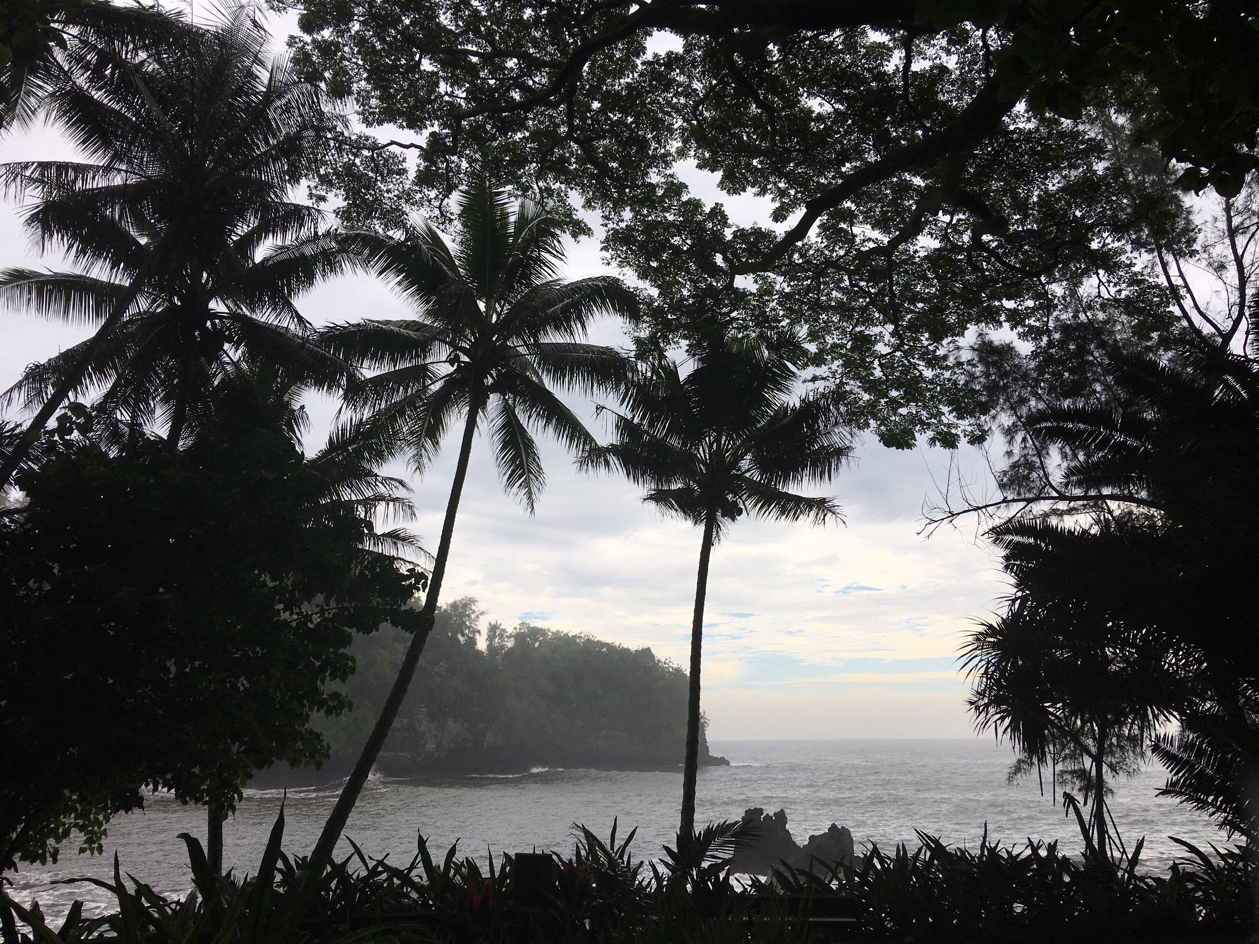
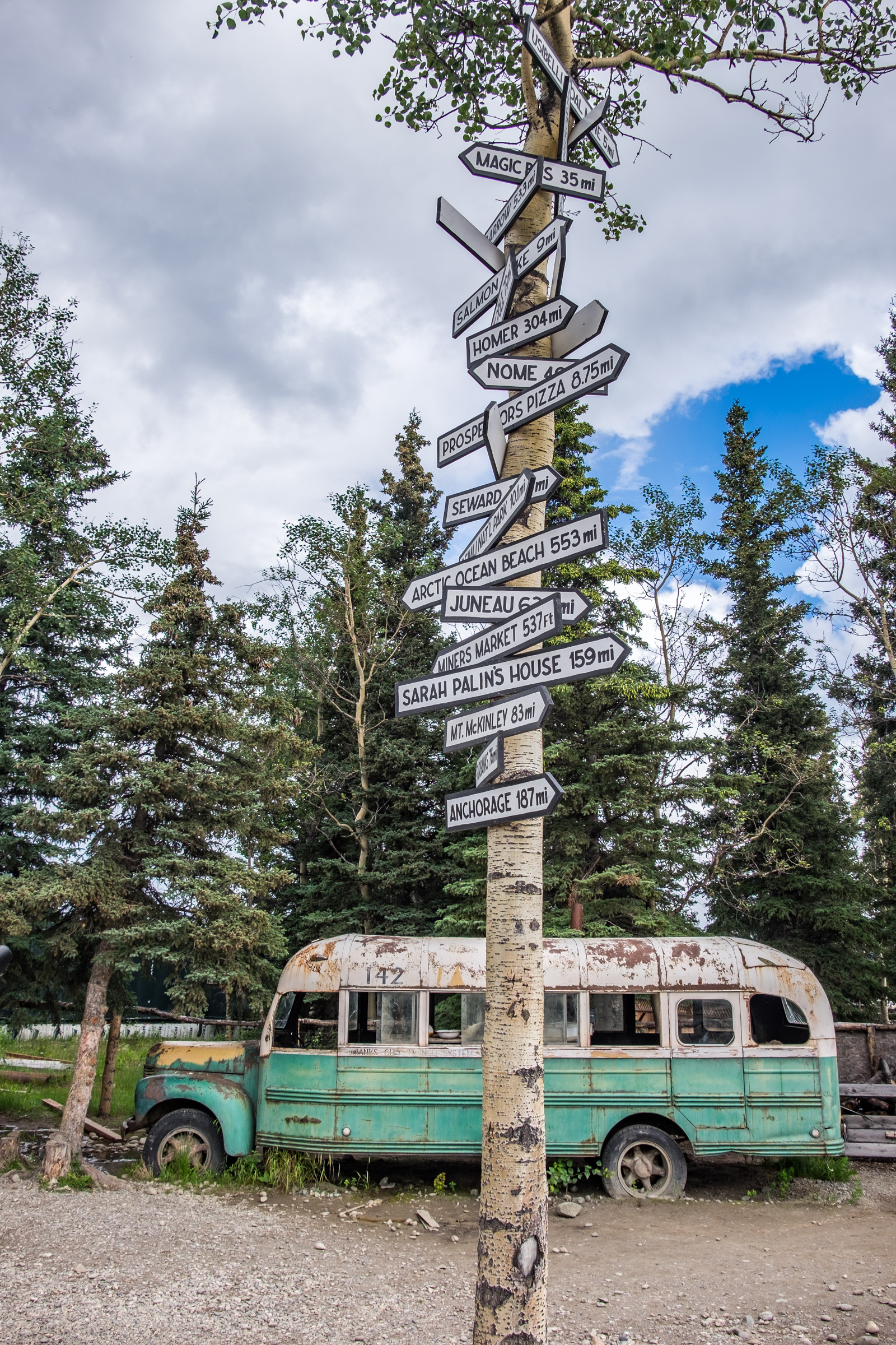
While we typically reserve posts on this page for stops that exist outside of our national parks, Hetch Hetchy Valley is a unique case that fits well here because it feels entirely separate from the wilds of Yosemite National Park. It is located inside of park boundaries and it always has been, though its function has changed from that of a thriving natural ecosystem to a hydroelectric reservoir providing the city of San Francisco with portions of their water supply. It is recorded that Raker Bill that would allow the intentional flooding of the valley was to be John Muir’s final heartbreak before he died—he considered the Hetch Hetchy Valley to be the perfect counterpart to his beloved Yosemite Valley. 

After spending a day at Hetch Hetchy, we knew that we wanted to share a sidebar on our site about its complicated past. To do so, we sought out a leading expert to better explain the backstory of how the reservoir came to be, the pros and cons of its existence, and steps that are being made to restore it to its natural state. 

With that, we offer our warmest thanks to Spreck Rosekrans, Executive Director of the Restore Hetch Hetchy Foundation, for taking the time to shed some light on this most special place that has deeply affected the landscape of Yosemite National Park.   


Jonathan Irish and Stefanie Payne (JI & SP):

When we visited Hetch Hetchy, we were struck by how similar it must have looked to Yosemite Valley in its original state. Can you give us a brief description of what Hetch Hetchy Valley looked like when John Muir first laid eyes upon it? 

Spreck Rosekrans (SR): 

John Muir and others lobbied for the creation of Yosemite National Park with boundaries that would include Hetch Hetchy Valley. As you may know, Yosemite Valley had been ceded to California in 1864 by President Lincoln for preservation – the first such action anywhere in the world, but Muir et al. thought Yosemite should be much larger. 

Muir said: After my first visit, in the autumn of 1871, I have always called it the Tuolumne Yosemite, for it is a wonderfully exact counterpart of the great Yosemite, not only in its crystal river and sublime rocks and waterfalls, but in the gardens, groves, and meadows of its flower park-like floor. The floor of Yosemite is about 4,000 feet above the sea, the Hetch -Hetchy floor about 3,700; the walls of both are of gray granite, rise abruptly out of the flowery grass and groves are sculptured in the same style, and in both every rock is a glacial monument.


JI & SP:

Today, Hetch Hetchy Valley is a dammed and flooded reservoir. How did federally protected land become appropriated for the use of a single city? 

SR:

San Francisco had been seeking an improved water supply for years. They evaluated a number of sites but liked Hetch Hetchy best, in part because it would also generate hydropower. They were denied several times, as it was in a national park. But when the 1906 earthquake and fire destroyed much of the city, opposition in DC softened (including Teddy Roosevelt). Bare in mind that the city had water in reservoirs after the earthquake but pipes within the city broke. The city had been fighting with its water supplier, the private Spring Valley Water Company. So going after the Tuolumne River and Hetch Hetchy involved creating a public water system as well as the project itself.

President Taft succeeded Roosevelt in 1908, met with Muir in Yosemite and seemed to want to keep Yosemite intact. So San Francisco realized legislation was necessary. 

When Wilson was elected in 1912 (after Roosevelt and Taft split the Republican party), he appointed Franklin Lane SF’s City Attorney as Secretary of Interior and pushed hard form restoration. The Raker Act passed the house in late summer. 200 newspapers editorials were published in opposition. The Senate debated it for 6 days. Many abstained, many opposed, but the bill passed. Wilson signed the bill.


JI & SP:

What role did Hetch Hetchy play in the passage of the National Park Service Act in 1916?

SR:

A bill to create a National Park Service (NPS) had been proposed but had opposition. The unprecedented controversy over Hetch Hetchy tipped the scales and the NPS bill carried easily less than three years later.

See Clark Bunting’s essay wherein he writes: “Thanks to the heated public debate inspired by Hetch Hetchy, the Organic Act clearly stated America’s commitment “to conserve the scenery and the natural and historic objects and the wild life therein and to provide for the enjoyment of the same in such manner and by such means as will leave them unimpaired for the enjoyment of future generations.”


JI & SP:

San Francisco relies heavily on the Hetch Hetchy Valley for public water and hydropower. Restoring Hetch Hetchy would entail finding other sources for the cities' consumption. What are the alternative options?

SR: 

First, Hetch Hetchy is one of nine reservoirs in San Francisco’s (SF) system. SF’s water rights on the Tuolumne would not change. See diagram below. Don Pedro is 6 times as large as Hetch Hetchy. 1/3 of it, or twice the volume of Hetch Hetchy, is a water bank for SF. Water system reliability would still be good, but SF would need minor new plumbing fixes and to invest in additional surface or groundwater storage, water transfers from agriculture or recycling within SF and its service territory. These are all doable and are much less than what other California water agencies have done to reduce their impact on the environment. In particular, local irrigation districts could recharge groundwater basins in wet years with SF’s water, and withdraw it in dry years. The amount, about 60,000 af per year, is not challenging from a physical perspective, but would require improved cooperation with irrigation districts. 

San Francisco would lose about 20% of its Sierra hydropower – would need to be replaced with solar.

Diagram showing San Francisco water routes. Courtesy of Restore Hetch Hetchy.

Diagram showing San Francisco water routes. Courtesy of Restore Hetch Hetchy.


JI & SP:

What are the arguments opposing restoration?

SR:

  • Water supply
  • Hydropower
  • Water quality (additional treatment would be required)
  • Money
  • Emotion

Mostly they have a “we stole it fair and square” attitude. The claim is that the cost of restoration would be much larger than our estimates, but we have never been able to have a real conversation about the discrepancies in estimates. That is what we hope to have in court. 

Our petition asserts the following, which we will have to back up with expert testimony in an evidentiary hearing (which they are trying to avoid):

These are our projected costs, over 50 years. From our petition — “The cost of replacing water storage in Hetch Hetchy Valley to maintain the current levels of water service and electrical power production by CCSF would be approximately 2 billion dollars, including 199 million dollars for additional interties, 372 million dollars for water supply, 387 million dollars for water treatment, 669 million dollars in for renewable electric power, and 374 million dollars for modifying the O’Shaughnessy Dam.” 


JI & SP:

How long would a full restoration of Hetch Hetchy take? Give us a short timeline of events.

SR:

Mostly reliant on the 1987 NPS report:

·         The valley would be spectacular almost right away.

·         There is little sediment and the Tuolumne River would return to its natural bed.

·         Within a few years, grasses and sedges would be reestablished and wildlife would return.

·         The “bathtub ring” would fade as lichen would reestablish itself on the canyon walls over a few decades.

·         It would take longer to grow a mature forest. Planting saplings would speed up the process.

·         What a great opportunity for families to visit the valley every few years and what it come back to life as the children grow up.


Click here to read the National Park Service’ 1987 report.   

An example, under “moderate management”: 

VEGETATION RESPONSE: FIVE YEARS AFTER BEGINNING OF DRAINAGE: The entire valley would be exposed and partially planted with native vegetation. Vegetation at the upper end of Hetch Hetchy would be much Burr extensive and well developed than at the lower end. Conifers would be up to fifteen feet high and black oaks would be about six feet high in areas planted the first year. Many native herbaceous taxa would have become germinated and would have established in some areas. Non-native taxa would be common in the valley and would have achieved dominance over the natives in most areas. 


JI & SP:

How much of the restoration would be natural and how much would be man made? Other than dismantling the dam and removing the man-made structures, would the nature in the valley restore on its own or would it need help?

SR: 

That is to be determined. The NPS report considers 3 levels of management. “Moderate” makes sense. Keep invasive species out. Plant trees in accordance with historical photographs (more meadows than forest as Yosemite Valley used to be as well.)


JI & SP:

You are currently fighting this battle in the courts. What hurdles remain in getting a restoration bill passed?

SR: 

We need a leader in Congress who is not afraid of taking on San Francisco, who understands water system reliability and real solutions, and cares about the legacy of our national parks. Many are intrigued, but no one is ready to take this on—yet.


JI & SP:

How can people get involved?

SR:

People should sign up for our newsletter through our website to learn more and to stay in touch. We send hard copy 2-3 times per year and (almost) weekly email blogs. 

Restore Hetch Hetchy is also active on TwitterFacebook, and Instagram.


The Best Lobster Roll Near Acadia National Park?

No matter where we travel, we always make a point to taste the local flavor—you can learn a lot about the culture of a place by chowing on eats that you might find on a Sunday dinner table. In Maine the quest was easy: find the best lobster roll near Acadia National Park. As travelers working a photo project, we grouped it with a scenic drive that we were told by a local at the Thirsty Whale in Bar Harbor (our favorite eatery in town) was a more beautiful route back to the Interstate than its alternative, traveling about the same distance.

There is something so summery and magical about ordering off of an outdoor wall menu! 

There is something so summery and magical about ordering off of an outdoor wall menu! 

In the town of Bucksport off of route 46, we made a stop at Carrier’s Mainely Lobster, a go-to for locals and a summer favorite in central Maine. They pride themselves on having some of the freshest lobster in the area, and we can vouch -- it was as fresh-tasting as lobster can be. On the wall of the outdoor eatery are lobster nets and buoys (perfect Instax fodder), and a roster of local lobstermen who captain the lobster boats catching the daily feed. The youngest at the time of our visit was 13, the oldest, in his 70s. 

Maine lobster rolls, curly seasoned fries, crisp slaw, and a couple of sodas was the order up. It was insanely good and definitely the type of meal that is hard to recreate in a kitchen anywhere outside of Maine. 

From their website: "Our boats went out yesterday, we cooked & picked the lobster this morning, now we’re making your lobster roll, That’s fresh!”

Since we were only able to try this one place during this visit to the area, we are curious of our readers: do you have a favorite lobster roll spot in Maine?

Nevada Three Ways

We've made four main stops in Nevada this year, one while exploring the Rhyolite area of Death Valley National Park in March, and three in May: Las Vegas, Valley of Fire State Park, and of course, park 20/59: Great Basin National Park. We've both been to Nevada to visit Vegas and Tahoe in the past, but it was while exploring outward of those popular areas more recently that we started to truly embrace the beauty of lesser-known Nevada. The 36th state has draws reaching far wider than what it is best known for and we wanted to share with you some of that. And of course we will include Vegas (it would be a crime not to), an ultimate road trip destination and one of our few stops in civilization this year.


Vegas! (It should always have an exclamation point.)

The Strip at night.

No trip to Nevada can ever be complete without a stop in Las Vegas! Vegas—belovedly known as Sin City—is America’s favorite desert metropolis where quickie weddings, gambling, glitz, glamour, iconic hotels, showbiz, and wild nights coalesce. Aside from the hoopla, Vegas has morphed into one of the most sophisticated cities in the country drawing tourists from all over America and the world to experience 5 star-everything while still offering the mid-century mystique of leather banquettes, tables and slots, showgirls, buffets, and over-the-top light shows that made The Strip and state famous. We traveled to Vegas from Great Basin on the Great Basin Highway, Highway 93, a route where local Nevadians and tourists can check in this year (tag #DiscoverNV16) on six designated road trip stops while exploring the great state of Nevada. This is definitely the year of the parks! It's cool to see how states are participating at a local level.

Valley of Fire State Park

Nevada's Valley of Fire State Park.

Just outside of Las Vegas is Nevada's oldest and largest state park, the Valley of Fire. This prehistoric landscape was long ago underfoot of dinosaurs and today offers a sanctuary just outside of Vegas where nature buffs can experience a very unique and vibrantly textured sandstone landscape that is endlessly fascinating. We didn’t have a whole lot of time to spend there, and as it’s a beautiful place to both photograph and explore, it’s going on the “go-back-to” list that we are compiling this year as we find ourselves leaving enchanting places much too soon...  


Great Basin National Park

Did you know that Nevada is the most mountainous of any state in America? This is because of a process occurring in Great Basin National Park. 

There are many, many, many, many reasons to visit this park—to catch a glimpse of the world’s oldest living trees, to wander inside the subterranean environment beneath our planet's surface, to brave world-class hikes and climbs, to observe with the lens dramatic weather patterns creating even more dramatic skyscapes … Great Basin National Park is a lesser-visited national park and a place of extremes and of immense wilderness and solitude. We hope you'll enjoy our writeup on park #20, and that you'll have a visit for yourself. 

Cheers and happy trails! 

Meteor Crater, Winslow, Arizona

En route from Petrified Forest National Park to the Grand Canyon, we made an unplanned stop at Meteor Crater in Winslow, Arizona. When signs reading Site of the World’s Largest Crater Impact, Straight Ahead!! pop up, one must stop to check it out, right? At the very least, these traffic signs were to make for terrific Instax material (which they did, but are at the present moment making way through a modernized filing system known on this adventure as "Ziplock bag sorting".)   

Meteor Crater is an impact site measuring nearly 600 feet deep and more than one mile across -- the result of an asteroid crashing into Earth 50,000 years ago. Space.com says that while the impact to Earth was not as fast and hard as astronomers once believed, the meteor still came screaming in 10 times faster than a rifle bullet. In any event, the speed in which the impact came in is no match for its visually impressive size. From the viewing areas (there are two that we know of) telescopes look out onto the crater floor where real life representations of astronauts, football fields, and other size comparisons sit to offer a perspective of scale. They all look like ants, even when magnified.

It was 20 bucks USD per person to get into the museum which leads to the crater. Always on a schedule and observing of budget, we weighed whether or not this expense would be worth it. We wanted to reach Grand Canyon well before sunset, which left us with only a little bit of time to observe Meteor Crater. All things considered, it was, in our opinion, best to be considered as a short stop between point A and B and we had no fuss moving along in about an hour. This categorization shouldn't take away from the wonder of seeing a massive impact site like this, and the thoughts it provokes made for lively conversation on the way to our next park. To imagine an asteroid weighing several hundreds of thousands of tons and traveling at 26,000 miles toward the surface of the Earth is a mind-bender (and a little bit scary.)

It's worth noting that Meteor Crater was designated as a National Natural Landmark in 1967 and is family owned which is why it doesn't have the Federal distinction as a National Monument. 

The Wigwam Motel on Route 66

The front entrance of the Wigwam Motel in Holbrook, Arizona.

This is more of a stop ON the road...

It is known as the Will Rogers Highway, the Main Street of America, and of course, The Mother Road. Whatever you like to call it, no great American road trip could ever be fully realized without a stop on America's famed Route 66. It cannot be found on any common map and the original route between Chicago and L.A. no longer exists, though broken pieces of it can still be traveled.

This way to everywhere! Follow your dreams. 

This way to everywhere! Follow your dreams. 

The highway of dreams has enticed wanderers, travelers, explorers since 1926. During the golden age of American road travel—the 1950s—pushing westward from the industrial Midwest to sunny California was a prestigious endeavor, and Route 66 was the prestigious route to take to travel to and fro.  

We’ve found ourselves on it a couple of times this year, but at no point thus far have we had the opportunity to drink in all of the photogenic kitsch that comes along with this dose of Americana than in Holbrook, Arizona (just outside of Petrified Forest National Park) at the Wigwam Motel.

Vintage cars dress the parking lot at Holbrook's Wigwam Motel. 

As I understand it, the original Wigwam Village was designed by architect Frank Redford and built in Cave City, Kentucky (where nearby you can visit Mammoth Cave National Park) in 1937. While the design was to mimic native American teepees, Redford was not a fan of the word so he called them “Wigwams.” A developer passing through soon after it was built bought rights to the design and fashioned six additional Wigwam Villages, totaling seven.

This location is one of only three still in existence (one other in aforementioned Kentucky; and one in California.) Not surprisingly, location #7 is on the National Register of Historic Places ... and it looks every bit the part. Vintage cars parked in the lot outside are a nod to its vintage past, providing a backdrop that feels more like you are on a movie set than at an operating motel. But it is still in business—the rooms can be rented by the night and true to original form, there is no wifi, cable TV, or telephone service (a trait we are finding to be quite common while on the road this year.)

Two of America’s very different wonders just stones throw from one another… not bad, AZ.   

Can't really think of anything more iconic than Wally the Airstream driving down the "Main Street of America."

Can't really think of anything more iconic than Wally the Airstream driving down the "Main Street of America."

One is never too young to have some fun on the Mother Road. 

One is never too young to have some fun on the Mother Road. 

Arizona-Sonora Desert Museum, Tucson, Arizona

We're sure this has happened to many travelers... You line up a side-stop at a landmark or popular attraction that you know nothing about and then it completely blows your mind. That's exactly what happened to us at the Arizona-Sonora Desert Museum in Tucson, en route to Saguaro National Park in Arizona.

Living in DC, we had the lion's share of top-tier museums that we patronized a lot. And this adventure is about parks, not so much about museums, so we were kind of in the casual "sure, let's check it out" mode when we went there. We left so happy that we went back again the following day because we wanted to explore it more... that says a lot considering the scarcity of free time we have this year.  

This isn't your typical museumit reminded us both a lot of the Smithsonian National Zoo, which was our outdoor haven while living in DC. It has 2 miles of outdoor walking paths that glide along 21 acres of natural habitat where desert wildlife thrives. Mountain lion, coyotes, javelina, grey fox, snakes, lizards, honey bees, and hummingbirdsall of which are naturally found in this biodiverse desert landscape in a slightly more concentrated area. 

A healthy looking roadrunner at the Desert Museum.

A healthy looking roadrunner at the Desert Museum.

From the museum website: …not a “museum” in the usual sense, it is an unparalleled composite of plant, animal, and geologic collections with the goal of making the Sonoran Desert accessible, understandable, and valued.

Goal achieved. In a short amount of time we easily visited, learned about, and appreciated at a higher level the natural makeup of this region. It is no wonder that this museum is consistently marked as one of the top ten best museums in the country and the top site to visit in Tucson (not to mention one of the stand out stops along our road trip this year.) Amazing!! 

Tex-Mex in Tucson: Guadalajara Original Grill

Burrito madness. Way too much food, but never there when you want it so you eat it all anyway... 

Burrito madness. Way too much food, but never there when you want it so you eat it all anyway... 

We may not know much about Tucson but we know a thing or two about great Tex-Mex food! Between TripAdvisor and Yelp we averaged one of the top-rated restaurants and gave it a try after a grueling hike and before a long overdue viewing of Star Wars: The Force Awakens. Review sites can't be entirely trusted, BUT, this place earned its high rating -- it was phenomenal with a capital YUM. Guadalajara Original Grill: YUM!! The service left a little to be desired in terms of speed and attention but really, with table-side salsa and guac, who really cares?! 

Table-side salsa and a vat of Margarita to share. :)

Table-side salsa and a vat of Margarita to share. :)

We sat next to a large Mexican family. They were related to the mariachi band, we think, because they sang and clapped and laughed together the way they would have at Sunday dinner. There was so much joy emanating from that table it was ridiculous. And they played with their soul -- even in the middle of a popular and very crowded restaurant -- so inspired that Stef got teary-eyed; margaritas so authentic that Jon vowed he'd never had one better. We almost missed Star Wars which we'd been clamoring to see since the year began, that's how much we were enjoying ourselves. Too long in DC with crappy options; too long of a day; whatever. It was too good. We've been hatching a route back through Tucson just to eat there again but it's not likely going to happen this year. A very delicious stop along the road.